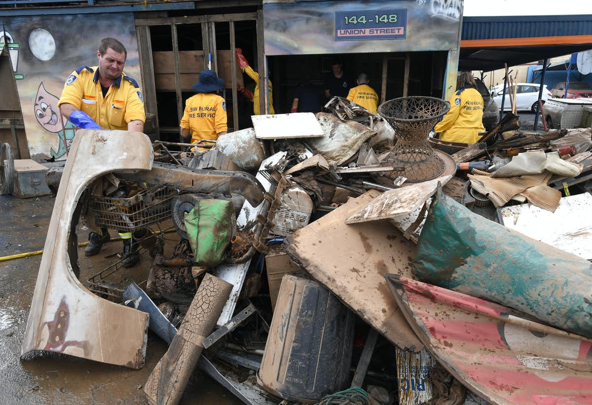
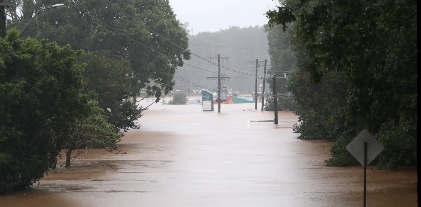
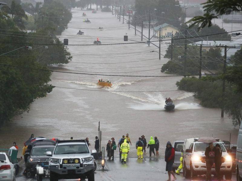
Foretaste of what Australia may see next summer?

Is this the beginning of the kind of multi-year drought that caused the US ‘dust bowl‘, famine and social disruption in the 1930s?

Concatenating catastrophes, where two different disasters join to make even worse chaos. NOAA/NASA via the New York Times

by Maggie Astor, 0v/05/2022 in New York Times

Smoke and Sandstorm, Seen From Space: A time-lapse image of smoke from wildfires in New Mexico and dust from a storm in Colorado illustrates the scope of Western catastrophe.

The video is mesmerizing: As three whitish-gray geysers gush eastward from the mountains of New Mexico, a sheet of brown spills down from the north like swash on a beach.

What it represents is far more destructive.

The image, a time-lapse captured by a National Oceanic and Atmospheric Administration satellite, shows two devastating events happening [at the same time] in the Western United States. The first is a wildfire outbreak in northern New Mexico that started last month and has intensified in the past two weeks, fueled by extreme drought and high winds. The second is a dust storm caused by violent winds in Colorado.

Both are examples of the sorts of natural disasters that are becoming more severe and frequent as a result of climate change.

Read thee complete article….

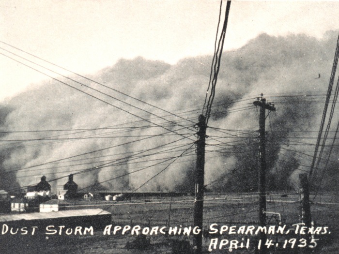
Featured Image: A dust storm approaching Spearman. In: Monthly Weather Review, Volume 63, April 1935, p. 148. Date: 1935 April 14 Location: Texas, Spearman …an excellent view of a dust storm that occurred at Spearman, Tex., on April 14, 1935. The photograph was submitted by the official in charge, Houston, Tex., and was taken by F. W. Brandt, cooperative observer at Spearman, Tex. Credit: US National Oceanic and Atmospheric Administration, National Weather Service / Public Domain / Wikipedia

Views expressed in this post are those of its author(s), not necessarily all Vote Climate One members.

UN global assessment report on disaster risk reduction

New UN report forecasts an increasing frequency of colliding and concatenating climate catastrophes and disasters from global warming

A car is flipped over after a tornado tore through the area in Arabi, La., Tuesday, March 22, 2022 in a part of the city that had been heavily damaged by Hurricane Katrina 17 years earlier. A United Nations report release on Monday, April 25, 2022, says disasters are on the rise and are just going to get worse. A new UN report says the number of disasters, from climate change to COVID-19, are going to jump to about 560 a year by 2030. (AP Photo/Herald Herbert)

by Seth Borenstein, 26/04/2022 in AP News

Weary of many disasters? UN says worse to come

A disaster-weary globe will be hit harder in the coming years by even more catastrophes colliding in an interconnected world, a United Nations report issued Monday says.

If current trends continue the world will go from around 400 disasters per year in 2015 to an onslaught of about 560 catastrophes a year by 2030, the scientific report by the United Nations Office for Disaster Risk Reduction said. By comparison from 1970 to 2000, the world suffered just 90 to 100 medium to large scale disasters a year, the report said.

The number of extreme heat waves in 2030 will be three times what it was in 2001 and there will be 30% more droughts, the report predicted. It’s not just natural disasters amplified by climate change, it’s COVID-19, economic meltdowns and food shortages. Climate change has a huge footprint in the number of disasters, report authors said.

Read the complete article….

Editors Comment: We have important choices to make in the upcoming election: Vote for our business as usual government who still largely act as if there was no emergency (e.g., keep shoveling as much coal as they can onto the fires of global warming), won’t prepare for disasters, and won’t hold a hose when a disaster happens; or you can try to elect candidates who have provided evidence that they will put action on the climate emergency at the top of their Parliamentary agendas. If you make the latter choice, Vote Climate One gives you Climate Sentinel News to inform your decision and our Traffic Light Voting Guides for every Australian electorate to show you how each candidate in your electorate ranks on climate action.

Featured image: Fig. 2. Occurrence by disaster type: 2020 compared to 2000-2019 annual average. Climate Action and Disaster Risk Reduction. From GLOBAL ASSESSMENT REPORT ON RISK REDUCTION – Our World at Risk: Transforming Governance for a Resilient Future.

Views expressed in this post are those of its author(s), not necessarily all Vote Climate One members.

Michael Mann on South African flooding catastrophe

In a warming world La Niña enables air over the ocean to carry more water vapor. When pushed into hills ashore, the vapor turns into floods.

Michael Mann discusses the deadly South African floods, the role that climate crisis is playing with these extreme events, and what we need to do about it, with BBC World News “The Context” (Apr 14, 2022

Featured Image: Area of extreme flooding, Durban, South Africa on the same latitude as the NSW northern coast area (e.g., Coffs Harbor) demonstrating the apparently global extent of NB4 rainfalls along this band of the world. (The Guardian also reports on these floods) / From Google Earth Pro, by William Hall. Public domain.

Views expressed in this post are those of its author(s), not necessarily all Vote Climate One members.

Famine is a likely result if global warming not stopped

Genetically restricted cultivars of major food crops likely to be early casualties of extreme temps and weather as world continues warming

Top: Cavendish banana plants infected with Panama 4 in the Philippines where the fungus has destroyed tens of thousands of acres of plantations. Below: on the left is the Cavendish plant root infected with the pathogen Panama 4, on the right is a healthy root. Photographs: Fernando Garcia-Bastidas / from the article

by Nina Lakhani, et al., 14/04/2022 in The Guardian

Our food system isn’t ready for the climate crisis: The world’s farms produce only a handful of varieties of bananas, avocados, coffee and other foods – leaving them more vulnerable to the climate breakdown

The climate breakdown is already threatening many of our favorite foods. In Asia, rice fields are being flooded with saltwater; cyclones have wiped out vanilla crops in Madagascar; in Central America higher temperatures ripen coffee too quickly; drought in sub–Saharan Africa is withering chickpea crops; and rising ocean acidity is killing oysters and scallops in American waters.

All our food systems – agriculture, forestry, fisheries and aquaculture – are buckling under the stress of rising temperatures, wildfires, droughts, and floods. 

Even in the best-case scenario, global heating is expected to make the earth less suitable for the crops that provide most of our calories. If no action is taken to curtail the climate crisis, crop losses will be devastating. 

Read the complete article….

Featured Image: A corn crop blighted with Southern corn leaf blight and stalk rot (Bipolaris maydis), by J.C. Wells, North Carolina State University, Bugwood.org / Creative Commons License   licensed under a Creative Commons Attribution-Noncommercial 3.0 License. / via Forestry Images

Views expressed in this post are those of its author(s), not necessarily all Vote Climate One members.

Bad outlook for our next El Niño fire season

Global Ecology and Biogeography journal article forecasts that extreme/widespread fire events under 2 °C will likely exceed anything yet seen

Representative day-of-burning maps for two fires that occurred in 2020, Cameron Peak and Holiday Farm. / From the article

by Coop et al., 19/03/2022 in Global Ecology and Biogeography

Extreme fire spread events and area burned under recent and future climate in the western USA

Results: Extreme single-day fire spread events >1,100 ha (the top 16%, >1 SD) accounted for 70% of the cumulative area burned over the period of analysis. The variation in annual area burned was closely tied to the number and mean size of spread events and distributional skewness towards more large events. For example, we identified 441 extreme events in 2020 that together burned 2.2 million ha across our study area, in contrast to an average of 168 per year that burned 0.5 million ha annually between 2002 and 2019. Fire season climate variables were correlated with the annual number of extreme events and area burned. Our models predicted that the annual number of extreme fire spread events more than double under a 2°C warming scenario, with an attendant doubling in the area burned.

Conclusions: Exceptional fire seasons like 2020 will become more likely, and wildfire activity under future extremes is predicted to exceed anything yet witnessed. Safeguarding human communities and supporting resilient ecosystems will require new lines of scientific inquiry, new land management approaches and accelerated climate mitigation efforts.

Read the complete article….

Featured Image: Hypothetical distribution of daily fire spread events during normal and extreme fire years. Increases in the annual area burned could potentially be accounted for by more fire spread events (number), larger event size (mean) and/or more large events (right skewness) / From the article

Views expressed in this post are those of its author(s), not necessarily all Vote Climate One members.

Rising crescendos: clusters of climate catastrophes

In a warming climate extreme weather events may encourage other extreme events to closely follow, e.g., fires followed by floods & landslides

Debris from a mudslide covers a home on January 10, 2018 in Montecito, California. Credit: Justin Sullivan/Getty Images / from the article.

by Andrea Thompson, on 01/04/2022 in Scientific American

Double Disaster: Wildfires Followed by Extreme Rainfall Are More Likely with Climate Change: These events can cause devastating landslides and flash floods

At 3:30 A.M. on January 9, 2018, half an inch of rain poured down on the charred slopes of the Santa Ynez Mountains in coastal southern California. The flames of the Thomas Fire—at the time the largest wildfire in state history—had swept through the previous month, leaving the soil and vegetation scorched and unable to soak up the onslaught of water. The destabilized ground gave way in a devastating landslide. Boulders crashed into houses in the town of Montecito, Calif., and a highway was buried under several feet of mud. The disaster killed 23 people and caused an estimate of around $200 million in damage.

Read the complete article….

See the scientific report that is the source of this article: Touma et al., 01/04/2022, Climate change increases risk of extreme rainfall following wildfire in the western United States in Science Advances

Featured Image: This image from a rescue helicopter records the burn scar from the Thomas Fire, as well as the path of a deadly mudslide in Montecito, Calif., in January 2018. Credit: California National Guard, CC BY 2.0 / from No Relief from Rain: Climate Change Fuels Compound Disasters: Climate change is increasing the risk of fire-rain events, raising mudslide concerns in fire-prone communities. by Leah Campbell, 12/12/2021 in EOS.

Views expressed in this post are those of its author(s), not necessarily all Vote Climate One members.

Floods and then more floods! Can we expect more yet?

Multiple floods in La Niña years are not unknown in Australia, but global warming can supply more water that makes extreme flooding even worse.

Jason O’Brien/AAP Image from the article

by Margaret Cook, 31/03/2022 in the Conversation

Why can floods like those in the Northern Rivers come in clusters?

Right now, Lismore residents are going through their second major flood in a month.

On February 28th, the devastating first flood peaked at 14.4 metres, fully two metres higher than the previous record of 12.27 metres in 1954, and well above the town’s 10-metre-high levee wall, constructed in 2005. Four people died, with 2000 homes destroyed or unlivable of the city’s 19,000.

Even as Lismore and Northern Rivers residents struggle to recover from the first flood, the floods are coming again. On March 29th, more heavy rain began falling onto the soaked catchment feeding into Wilsons River.

Read the complete article….

Featured Image: Lismore locals are still cleaning up after February’s floods – now they are being hit again. Darren England/AAP Image / from the article.

Views expressed in this post are those of its author(s), not necessarily all Vote Climate One members.

Excuse profanity, but Juice Media tells the truth

Floods and climate disasters will keep rising until global warming is reversed. Scummo’s govt. will only continue shoveling coal on the fire.

Honest Government Ad | The Floods
The Australian Government has made an ad about this summer’s floods and it’s surprisingly honest and informative – 17/03/2022 in thejuicemedia

Editor’s comment: This was recorded BEFORE the present NB4 flooding in a sequence of NB4 floods…. Think about who you are voting for!

Featured image: River levels could top 16 metres at Lismore amid more expected rain, the weather bureau says. / from Northern Beaches Review article 28/02/2022 by Australian Associated Press, NSW flood crisis ‘unprecedented’: premier

Views expressed in this post are those of its author(s), not necessarily all Vote Climate One members.

Antarctic ice shelf collapsed by recent NB4 heat spike

Satellite imagery shows last week’s unimaginable high temperature spike in East Antarctica has fueled the collapse of at least one ice shelf

Satellite data shows the Conger ice shelf has broken off iceberg C-38 and collapsed in Antartica. Photograph: USNIC (From the article)

by Donna Lu, 25/03/2022 in The Guardian

Satellite data shows entire Conger ice shelf has collapsed in Antarctica: Nasa scientist says complete collapse of ice shelf as big as Rome during unusually high temperatures is ‘sign of what might be coming’

Featured Image: Sketch of the Antarctic coast with glaciological and oceanographic processes. 7 April 2000. / Author: Hannes Grobe, Alfred Wegener Institute for Polar and Marine Research, Bremerhaven, Germany via Wikimedia / Permission: Own work, share alike, attribution required (Creative Commons CC-BY-SA-2.5)

Views expressed in this post are those of its author(s), not necessarily all Vote Climate One members.

Expert explains NB4 polar temperature extremes

Yale Climate Connections‘ Bob Hensen discusses and explains the unimaginable heat episodes observed at in north and south polar regions

A research caravan seen from above by a research drone in early 2020 on the East Antarctic Plateau south of Concordia Station. Concordia recorded its highest temperature in more than 15 years of data collection on March 18, 2022 – a date when temperatures are normally closer to their winter lows than summer highs. (Image credit: Pete Akers via Article)

by Bob Hensen, 23/03/2022 in Yale Climate Connections

How this month produced a mind-boggling warm-up in eastern Antarctica (and the Arctic): Two atmospheric rivers surge toward opposite poles:

The bloodless term “anomaly” doesn’t do justice to the stupendous temperature departures seen across parts of both the Antarctic and Arctic in mid-March 2022. With the initial shock now behind them, scientists are taking stock of exactly what happened and what it might portend.

Read the complete article….

Featured image: The high temperature at Concordia Station, Antarctica, on March 18, 2022, soared above any temperature on record, even from midsummer, in data going back to 2013. (Image credit: Eric Lagadec, via ASTEP from the Article).

Views expressed in this post are those of its author(s), not necessarily all Vote Climate One members.